We are Cascade!
Introducing our research group

About the Cascade research group
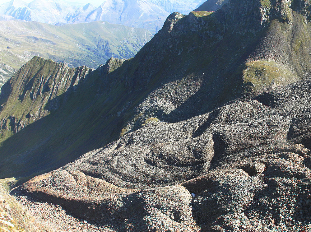
Mountainous regions feature dramatic landscapes and unique ecosystems that have fascinated humans for centuries. These areas provide society with various goods and services, such as water and recreational space. However, they also pose significant hazards and risks that are exacerbated by climate change and its associated environmental impacts. Geomorphological processes within mountain systems—such as glacier retreat leading to lake formation, warming and thawing of permafrost, landslides, rockfalls, and debris flows—are often closely interconnected. These processes can create cascading effects that manifest over different spatial and temporal scales, impacting the foreland and potentially leading to damage, and in the worst cases, disasters.
The Cascade research group aims to enhance the understanding of geomorphological processes and the associated human-environment interactions in mountainous regions, thereby improving the foundation for appropriate management of the corresponding opportunities and risks. This endeavor necessitates the integration of diverse competencies and methodologies. In particular, the dissemination of knowledge and skills to learners at various levels is a primary focus.
Most of the current research projects of the Cascade group are funded by third-party sources, with some projects also receiving internal funding. We collaborate nationally with partners in the fields of geography, nature conservation, forestry, hydraulic engineering, geology, climatology, and natural hazard research. Furthermore, we maintain a wide range of international collaborations, not only with neighboring countries but also with partners around the globe. Our research areas encompass mountainous regions worldwide, with current focal points in the Alps, the tropical Andes, and the Himalayas.

Natural hazards
The mass flow simulation tool (Funding: internal)
Selected publications:
- Fischer J.T., Kofler A., Huber A., Fellin W., Mergili M., Oberguggenberger M., 2020: Bayesian inference in snow avalanche simulation with r.avaflow. Geosciences 10: 191. https://doi.org/10.3390/geosciences10050191
- Mergili M., Jaboyedoff M., Pullarello J., Pudasaini S.P. 2020: Back-calculation of the 2017 Piz Cengalo-Bondo landslide cascade with r.avaflow. Natural Hazards and Earth System Sciences 20: 505-520. https://doi.org/10.5194/nhess-20-505-2020
The open source GIS slope stability model (Funding: internal)
Selected publications:
- Palacio J., Mergili M., Aristizábal E., 2020: Probabilistic landslide susceptibility analysis in tropical mountainous terrain using the physically based r.slope.stability model. Natural Hazards and Earth System Sciences 20: 815-829. https://doi.org/10.5194/nhess-20-815-2020
A multi-functional conceptual tool for mass movement routing (Funding: internal)
Selected publications:
- Mergili M., Schwarz L., Kociu A., 2019: Combining release and runout in statistical landslide susceptibility modeling. Landslides 16(11): 2151-2165. https://doi.org/10.1007/s10346-019-01222-7
The GLOP project aims at understanding the distribution, temporal development and changes in glacial lakes and glacial lake outburst floods (GLOFs) across the Peruvian Andes. Specific objectives include climate change modelling, glacial lake mapping and GLOF hazard assessment and modelling. The team consists of experts from the UK, Peru and Austria. (Funding Uni-Graz: internal)
Selected publications:
- Mergili M., Pudasaini S.P., Emmer A., Fischer J.T., Cochachin A., Frey H., 2020: Reconstruction of the 1941 multi-lake outburst flood at Lake Palcacocha (Cordillera Blanca, Peru). Hydrology and Earth System Sciences 24: 93-114. https://doi.org/10.5194/hess-24-93-2020
- Emmer, A., Harrison, S., Mergili, M., Allen, S., Frey, H., Huggel, C. (2020): 70 years of lake evolution and glacial lake outburst floods in the Cordillera Blanca (Peru) and implications for the future. Geomorphology: 107178. https://doi.org/10.1016/j.geomorph.2020.107178
- Emmer, A., Wood, J.L., Cook, S.J., Harrison, S., Wilson, R., Diaz-Moreno, A., Reynolds, J.M., Torres, J.C., Yarleque, C., Mergili, M., Jara, H.W., Bennett, G., Caballero, A., Glasser, N.F., Melgarejo, E., Riveros, C., Shannon, S., Turpo, E., Tinoco, T., Torres, L., Garay, D., Villafane, H., Garrido, H., Martinez, C., Apaza, N., Araujo, J., Poma, C., 2022. 160 Glacial lake outburst floods (GLOFs) across the Tropical Andes since the Little Ice Age. Global and Planetary Change, 208(1), 103722. doi. org/10.1016/j.gloplacha.2021.103722
- Emmer, A. (2023). Vanishing evidence? On the longevity of GLOF diagnostic features in the Tropical Andes. Geomorphology, 422, 108552.
Hazard map for landslides for the municipality of Feldbach, Eastern Styria (funding: Austrian Rural Development Program 2014-2020, completed)
Selected publications:
- Currently no publication.
Natural hazard management of alpine torrent catchment areas (funding: internal)
Selected publications:
- Kamp N., Langegger F., Funder M., 2018: Natural hazard management of alpine torrent catchment areas: Conception, implementation and validation of pyAlpineRisk. In: Torrent and avalanche control. Journal for torrent, avalanche, erosion and rockfall protection. Protection against natural hazards - Ecological aspects, 182, 356-367.
- Kamp N., Langegger F., 2018: GIS tool for determining the storage space of debris barriers and flood retention basins. In: Torrent and avalanche control. Journal for torrent, avalanche, erosion and rockfall protection. Barrage construction - barrier types - barrier functions, 181,324-327.
-
Kamp N., Langegger F. (2021). Development of QGIS tools for daily workflows using the example of a range estimation using a flat-rate slope approach according to ÖROK (2015). In: Journal for torrent, avalanche, erosion and rockfall protection. Rockfall, 187: 260-265.
Modeling future runoff and sediment transport in alpine torrents (together with CC-MoRe) (Funding: ACRP)
Selected publications :
- Peßenteiner S., Gegenleithner S., Kamp N., Krenn P., 2020: Modeling past and future runoff and sediment loads with free software - Insights from the example of the Schöttlbach (Niedere Tauern). Österr Wasser- und Abfallw 72, 308-319. https://link.springer.com/article/10.1007%2Fs00506-020-00675-8
- Krenn P., Peßenteiner S., Kamp N., 2019: The 2017 torrent event in the Schöttlbach catchment (Oberwölz) - a geomorphological inventory using UAV-borne laser scanning (ULS). In: Torrent and avalanche control. Journal for torrent, avalanche, erosion and rockfall protection. Hazard zone planning, 184, 224-237.
- Peßenteiner, S., Krenn, P., Gegenleithner, S., Kamp, N., Schöner, W., Sass, O., Schneider, J., Schrei, B., Gaisberger, Ch. (2022). Modeling of future discharges and bedloads in the Schöttlbach catchment (Styria). In: Journal of Torrent, Avalanche, Erosion and Rockfall Protection. Natural hazards in climate change, 190: 154-166.
-
Kamp, N., Krenn, P., Avian, M., Sass, O. (2023). Comparability of Multi-Temporal DTMs derived from different LiDAR Platforms: Error Sources and Uncertainties in the Application of Geomorphic Impact Studies
More about the RunSed-CC project
Glacial-periglacial
Annual monitoring of glacier change on the Pasterze and its neighboring glaciers (sponsored by the Austrian Alpine Association/ÖAV)
Selected publications:
- Lieb G.K., Kellerer-Pirklbauer A., 2018: The Pasterze, Austria's largest glacier, and its long series of measurements in an era of massive glacier retreat. Fischer, A., G. Patzelt, M. Achrainer, G. Groß, G. K. Lieb, A. Kellerer-Pirklbauer & G. Bendler (eds): Gletscher im Wandel: 125 Jahre Gletschermessdienst des Alpenvereins. Berlin. Springer Spektrum. 2018. 31-51. https://doi.org/10.1007/978-3-662-55540-8_4
- Kellerer-Pirklbauer A., Kulmer B., 2019: The evolution of brittle and ductile structures at the surface of a partly debris-covered, rapidly thinning and slowly moving glacier in 1998-2012 (Pasterze Glacier, Austria). Earth Surface Processes and Landforms 44, 1034-1049. https://doi.org/10.1002/esp.4552
Monitoring of permafrost and permafrost-related landscapes in the Hohe Tauern and their relation to climate and climate change (Funding: Austrian Alpine Association/ÖAV - Patenschaftsfonds and Hohe Tauern National Park Carinthia)
Selected publications:
- Kellerer-Pirklbauer A., 2019: Long-term monitoring of sporadic permafrost at the eastern margin of the European Alps (Hochreichart, Seckauer Tauern range, Austria). Permafrost and Periglacial Processes, 30/4, 260-277. https://doi.org/10.1002/ppp.2021
- Kellerer-Pirklbauer A., Lieb G.K., 2017: Permafrost monitoring in the Austrian Alps: A field of work at the Institute of Geography and Spatial Research. In: GEOGRAZ. Grazer Mitteilungen der Geographie und Raumforschung. 60. 2017. 11-16.
Long-term ecosystem monitoring in the Hohe Tauern National Park: Module 07: Cryosphere: Glaciers, hydroclimate, permafrost (Funding: Hohe Tauern National Park)
Selected publications:
- Lieb G.K., Kellerer-Pirklbauer A., 2018: Monitoring of abiotic natural processes in the Hohe Tauern National Park, Austria: A long-term approach. In: Salzburg National Park Fund (ed.): 6th Symposium for Research in Protected Areas - Conference Proceedings. Salzburg. Salzburg National Park Fund. 2018. 379-381.
- Körner C., Tappeiner U., Newesely C., Wittmann H., Eberl T., Kaiser R., Meyer E., Grube M., Fernández Mendoza F., Füreder L., Niedrist G.H., Daim A., Lieb G.K., Kellerer-Pirklbauer A., Wickham S., Petermann J., Berninger U., 2020: Long-term monitoring of ecosystem processes in the Hohe Tauern National Park. Synthesis of the start phase 2016-2018. Publisher of the Austrian Academy of Sciences, Vienna. ISBN-Online: 978-3-7001-8748-6. https://doi.org/10.1553/GCP_LZM_NPHT_Synthese
Coordination and management of the Austrian Alpine Association's glacier measurement service (funding: Austrian Alpine Association/ÖAV)
Selected publications:
- Lieb G.K., Kellerer-Pirklbauer A., 2019: Glacier Report 2017/2018 - Collective report on the glacier measurements of the Austrian Alpine Association in 2018. Bergauf 2/2019, Vol. 74 (144), pp. 20-29.
- Lieb G.K., Kellerer-Pirklbauer A., 2020: Glacier Report 2018/2019 - Collective report on the glacier measurements of the Austrian Alpine Club in 2019. Bergauf 2/2020, Vol. 75 (145), pp. 6-15.
Quantification and monitoring of dead ice deposits in the glacier forefield of Austria's largest glacier (funding: Glockner Eco-Fund, completed)
Selected publications:
- Kellerer-Pirklbauer A., Avian M., Benn D.I., Bernsteiner F., Krisch P., Ziesler C., 2020: Buoyant calving and ice-contact lake evolution at Pasterze Glacier (Austria) in the period 1998-2019, The Cryosphere Discuss, in review. https://doi.org/10.5194/tc-2020-227
- Seier G., Kellerer-Pirklbauer A., Sulzer W., Ziesler C., Krisch P., Abermann J., Lieb G.K., 2020: The rapid glacial-proglacial landscape modification at Pasterze Glacier in a one-year period as revealed by multiple aerial flight and field campaigns. EGU2020-9224. https://doi.org/10.5194/egusphere-egu2020-9224
Speleology
Application of geophysical and geotechnical methods in physical speleology (funding: internal)
Selected publications:
- Bauer C., Droin A., 2020: Derivation of high-resolution terrain models in caves using photogrammetric methods to analyze microscale karst forms. Landesverein für Höhlenkunde in der Steiermark, 48: 37-41.
- Kaufmann V., Bauer C., Strmsek B., Mikl T., 2020: Naturräumliche Gegebenheiten und dreidimensionale Vermessung des Luftschutzstollens Schloss St. Martin, Graz. In: Wunderlich, M. (ed.): Engineering Surveying 20 - Contributions to the 19th International Engineering Surveying Course Munich. Wichmann: 451-464.
Quantification of karst morphological phenomena with a focus on Styria (funding: internal)
Selected publications:
- Bauer C., Weissinger A., 2020: Die Karstvorkommen der Leithakalk-Areale entlang der Mittelsteirischen Schwelle (Steirisches Becken). Die Höhle: Zeitschrift für Karst- und Höhlenkunde, 71, 105-119.
- Bauer C., Plan L.(in print): Karst Landscapes of Austria. International Association of Geomorphologists.
Weathering
The Role of TEmperature, MOisture and Salts for Weathering Patterns:
Part I: Impact of moisture on rock weathering and on the decay of cultural heritage
Part II: Moisture, salt and weathering dynamics on historic urban walls in Oxford (UK) and Graz (funding: internal)
Selected publications:
More about the research project TEMOS
People and the environment
Climatic and anthropogenic drivers of land use change in the Tafilalet, Morocco (Funding: internal)
Selected publications:
- Currently no publication.
The 1815 Tambora eruption and its impact on Admont - Quantification of the long-distance impact of the 1815 eruption on meteorological conditions in Admont based on historical weather records. (Funding: internal)
Selected publications:
- Currently no publication.
Quantification of the effects of a Vb cyclone in 1572 at regional and local level based on a detailed damage inventory (Funding: internal, completed)
Selected publications:
- Eulenstein J., Kellerer-Pirklbauer A., 2020: The central European flood of 1572 and its local-scale effects as revealed by a damage inventory. Hydrological Sciences Journal, 65/6, 884-897. https://doi.org/10.1080/02626667.2020.1716980
- Eulenstein J., Kellerer-Pirklbauer A., 2019: Interdisciplinarity between historians and geographers in the field of natural hazards research - The example of a damage inventory on the effects of a Vb cyclone in 1572 from Admont, Austria. Mitteilungen der Österreichischen Geographischen Gesellschaft, 161, 189-214. https://doi.org/10.1553/moegg161s189
Interdisciplinary cooperation platform in the field of environmental monitoring (funding: internal)
Selected publications:
- Seier G., Schöttl S., Kellerer-Pirklbauer A., Glück R., Lieb G.K., Hofstadler D.N., Sulzer W., 2020: Riverine Sediment Changes and Channel Pattern of a Gravel-Bed Mountain Torrent. Remote Sens. 2020, 12, 3065. https://doi.org/10.3390/rs12183065
- Seier G., Kellerer-Pirklbauer A., Abermann J., Bauer C., Sulzer W., Landl N., Glück R., Schöttl S., Lieb G.K., 2020: Modern technology in the service of research using the example of Langgriesgraben. In the Gseis (National Park Gesäsue Magazine). 34. 2020. 22-23.
Mapping and analysis of relics of past agricultural practices (Wölbäcker) as an indicator of forest transition. (Funding: internal)
Selected publications:
- Currently no publication.